
Waves are usually biggest when long-period swells from distant storms align with a favorable tide phase and light offshore winds. Three things drive that outcome: the raw energy built by wind over open water, the time that energy takes to organize into swell, and what the local coastline does with it once it arrives.
- Core physical drivers: NOAA confirms that wave size depends on wind strength, wind duration, and fetch (the unobstructed distance over which wind blows). Longer, stronger winds across a larger fetch produce taller, more powerful waves.
- Swell period: Long-period swell (roughly 14–20+ seconds between wave crests) carries far more energy to shore than short-period chop. Period matters as much as height when you’re reading a forecast.
- Safety flag: Before entering the water or planning a viewing trip during large surf, check the National Weather Service high-surf advisories. A high-surf advisory means conditions can be life-threatening even for experienced swimmers.
Table of Contents
- How wind strength, duration, and fetch build the biggest waves
- Why long-period swell produces bigger surf than local wind waves
- When waves are largest by season across U.S. coasts and Hawaii
- How local bathymetry, reefs, sandbars, and headlands shape wave size
- How to plan a safe surf session around swell, tide, and local conditions
- How atmospheric pressure systems drive wave generation
- Key Takeaways
- A surfer’s honest read on chasing big waves
- Ready to build toward bigger surf with Hhsurf?
- Useful sources for forecasts and wave education
How wind strength, duration, and fetch build the biggest waves
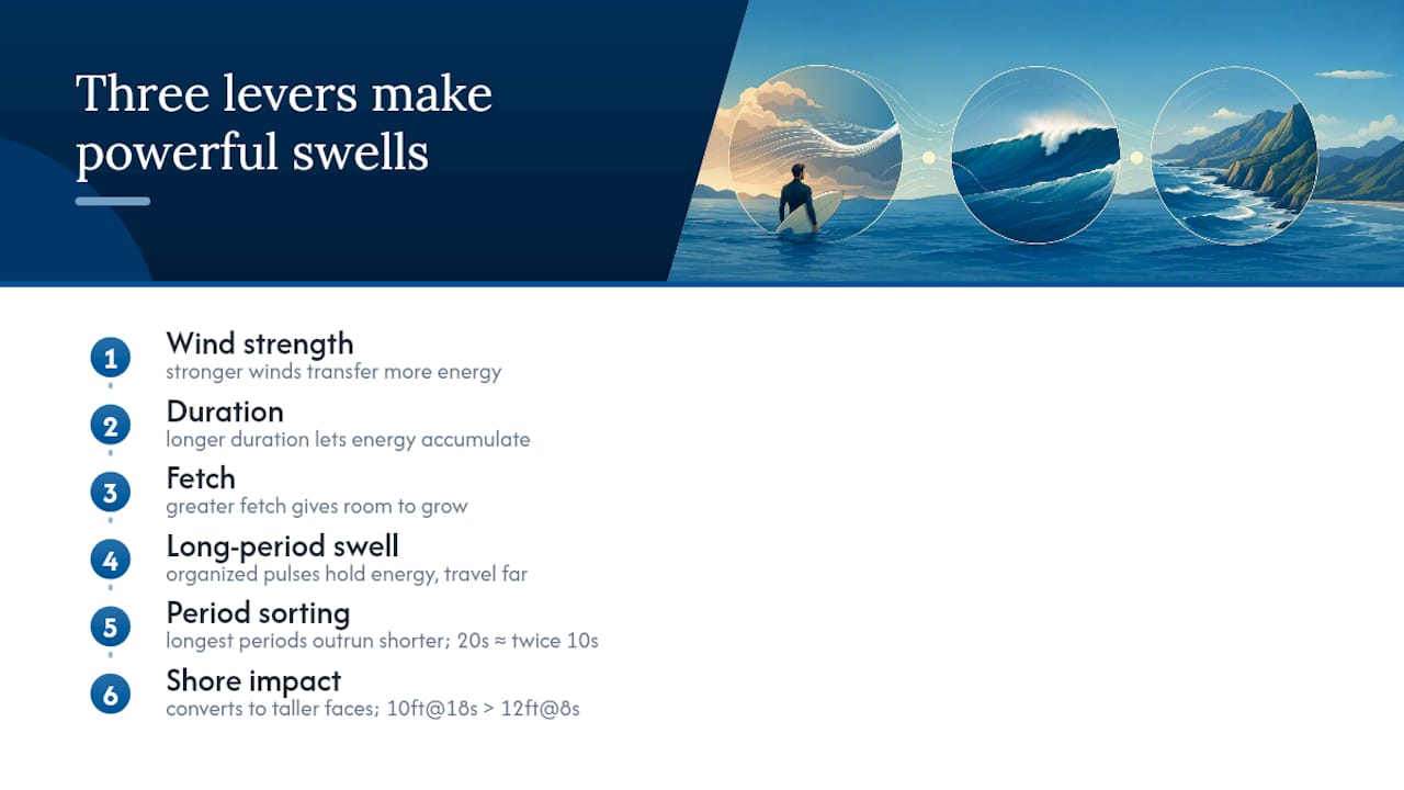
Wind, time, and distance are the three levers the ocean uses to build wave energy. Stronger winds transfer more energy to the water surface. Longer duration gives that energy time to accumulate. Greater fetch gives it room to grow. When all three are maximized, a single storm can generate swells that travel thousands of miles before they reach a coastline.
The energy in a long-period swell doesn’t dissipate the way short wind chop does. It travels as organized pulses through the water column, arriving at shore with nearly the same power it had when the storm generated it — sometimes days and thousands of miles later.
As those waves travel away from the storm, they sort themselves by period. The longest-period waves outrun the shorter ones, arriving first and carrying the most energy. A swell with a 20-second period moves roughly twice as fast as one at 10 seconds, and when it hits shallow water, that stored energy converts into wave height far more efficiently. National Geographic’s wave formation resource describes this energy transfer as the defining factor separating a rideable big wave from ordinary surf.
Pro Tip: When checking a biggest waves forecast, look at swell period before you look at height. A 10-foot swell at 18 seconds will break with more power and produce a taller face than a 12-foot swell at 8 seconds.
Why long-period swell produces bigger surf than local wind waves
The biggest rideable waves almost always come from long-period groundswell, not from locally generated wind waves. Local wind waves are chaotic, short-period, and steep. They pile up fast and fall apart just as quickly. Groundswell is the opposite: organized, smooth, and powerful.
Here’s how a swell is born and travels:
- A storm forms over open ocean and sustained winds begin transferring energy to the surface.
- As the storm persists, fetch grows and wave height increases; the energy starts organizing into longer-period sets.
- Swell radiates outward from the storm center in all directions, with the longest-period waves leading.
- Those waves travel across the ocean, often covering 2,000–5,000+ miles over 2–10 days depending on distance.
- They arrive at the coast as clean, powerful groundswell — often on a sunny, calm day with no local wind at all.
The practical difference shows up in face height versus significant wave height. Significant wave height (the average of the highest one-third of waves) is the standard metric in forecasts, but the actual face a surfer rides can be considerably taller. Long-period swell is the reason: it causes waves to stand up steeply as they shoal, producing faces that dwarf the forecast number. For surf forecasts, always read swell height, period, and direction together — never just the height alone.
When waves are largest by season across U.S. coasts and Hawaii
The biggest surf windows follow storm tracks. Winter storms dominate the Pacific; hurricane season drives the Atlantic and Gulf.
- Pacific Coast (Northern California, Pacific Northwest): November through March is the prime window. Mavericks at Half Moon Bay requires northwest swell with periods of 18–20+ seconds to produce its legendary 40–60-foot faces. Those conditions arrive almost exclusively from winter North Pacific storms.
- Hawaii (North Shore, Oahu): — The north-facing shores see their biggest surf from November through February as North Pacific swells wrap in. South-facing shores (including Waikiki) see their largest surf in summer when Southern Hemisphere storms send long-period south swells.
Reliable forecasting for a specific big-wave event typically extends only 2–4 days out. Seasonal windows tell you when to be ready; the actual forecast tells you when to go. Plan big-wave trips as flexible windows rather than fixed dates, and always check NWS marine and high-surf advisories before committing.
How local bathymetry, reefs, sandbars, and headlands shape wave size
The same swell that produces a knee-high ripple at one beach can generate a 30-foot face two miles away. Underwater topography is why.
Coastal shape and the seafloor beneath it determine how incoming swell energy converts into breaking wave height. A spot that focuses and concentrates swell energy will always punch above its forecast number.
Four mechanisms drive this:
Shoaling happens when a swell moves from deep to shallow water. The wave slows, its wavelength compresses, and its height increases. A steep, sudden depth change produces a dramatic, powerful break. A gradual slope dissipates energy over a longer distance.
Focusing occurs when underwater canyons or ridges channel swell energy toward a single point. The Nazaré Canyon in Portugal is the most extreme example: it funnels Atlantic groundswell directly toward the beach, concentrating energy that would otherwise spread across miles of coastline. That’s why Nazaré produces waves with faces reaching 86 feet (26.21 m), the largest officially surfed wave on record.
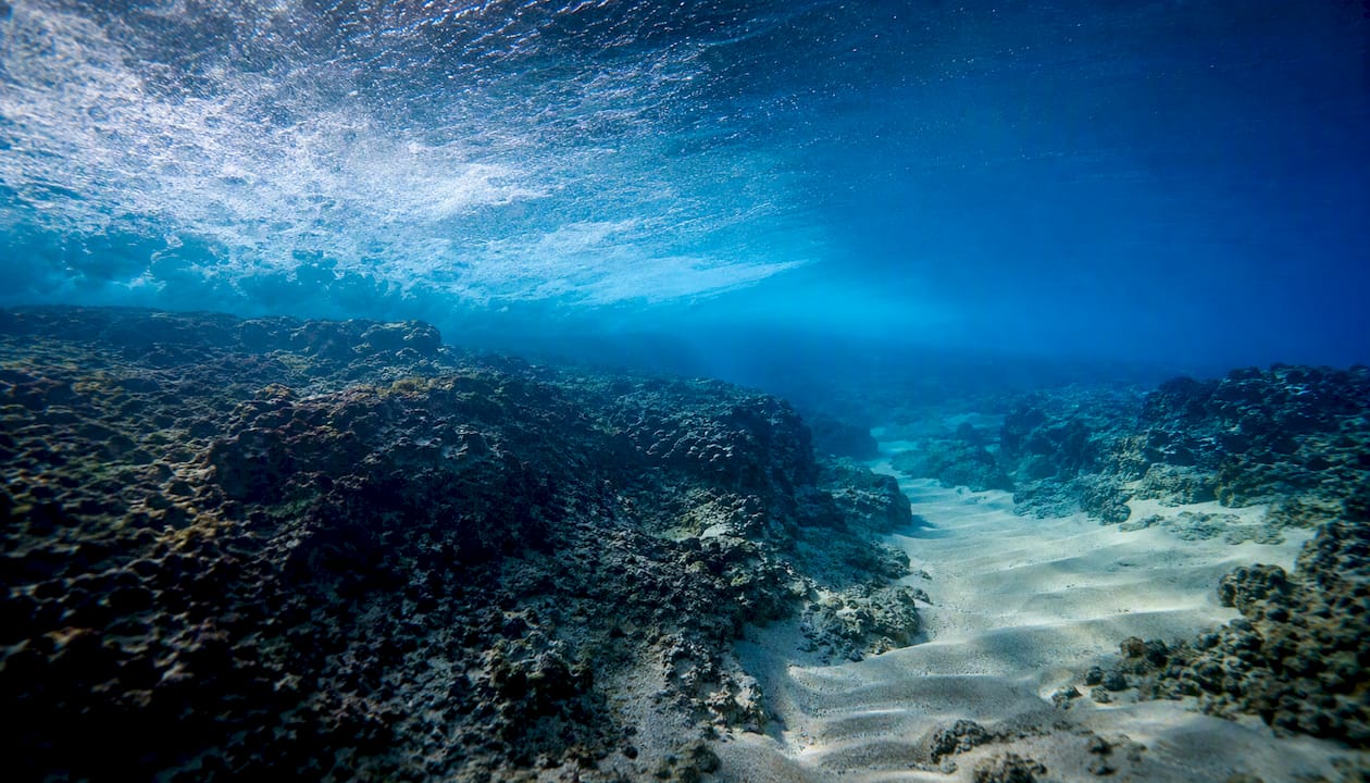
Refraction bends swell around headlands and points, wrapping energy into sheltered bays or focusing it at specific peaks. Point breaks work this way: the headland organizes the swell into long, predictable walls.
Sandbars shift seasonally and after storms, which is why a beach that was flat in spring can have a perfect peak by fall. Local knowledge matters here more than any chart.
Pro Tip: Always pair a regional swell forecast with local knowledge or a local surf report. The forecast tells you what’s coming; local knowledge tells you where it will actually break well. Understanding different surf break types helps you predict which spots will fire on a given swell.
How to plan a safe surf session around swell, tide, and local conditions
One sentence covers the core logic: check swell period and direction first, then tide phase for your specific break, then morning wind patterns, and match all of it to your skill level and equipment.
Big-wave expert Tom Ward puts it plainly: build up gradually and match conditions to your skill, rather than chasing raw size. That advice applies whether you’re targeting 6-foot beach break or 20-foot reef.
Here’s how to work through it before a session:
Read the swell forecast. Check height, period, and direction. A long-period northwest swell hitting a north-facing break is a very different day than a short-period south wind swell of the same height.
Check the tide table. Know whether your break works better at high, low, or mid-tide. Incoming tide often improves shape on reef breaks; low tide can make beach breaks hollow and dangerous for beginners.
Check the wind forecast. Aim for light offshore or calm conditions. Onshore winds above 10–15 mph typically ruin wave quality regardless of swell size.
Confirm NWS advisories. A high-surf advisory or warning changes the calculus entirely. These are issued when surf height and associated hazards exceed safe thresholds for the general public.
Match gear to conditions. Bigger, longer boards paddle into swell more easily. Leashes, appropriate wetsuits, and flotation matter more as size increases.
Plan entry and exit. Identify rip currents, rocks, and the safest paddle-out channel before you enter. Beginners should follow an instructor’s guidance and avoid big-wave-season conditions entirely until their skills are solid. Hhsurf’s beginner surf resources cover this progression in detail.
How atmospheric pressure systems drive wave generation
Low-pressure systems are the engines behind the biggest swells. A deep low-pressure center creates strong, sustained winds that spiral outward over a large area of ocean. The lower the pressure and the larger the system, the stronger the winds and the greater the fetch, which directly translates to larger, longer-period waves.
High-pressure systems work in the opposite direction. They produce calm, stable conditions with light winds, which is why a high sitting over your local coast often means clean, glassy surf from a distant swell rather than any locally generated size. The contrast between a distant low generating swell and a local high providing clean conditions is actually the ideal setup for the best big-wave days.
Forecasters track these pressure systems to predict swell several days in advance. A powerful extratropical low tracking across the North Pacific in November is the classic setup for a major Hawaii or California swell event. The storm’s track, central pressure, and duration all feed into swell models like NOAA’s WAVEWATCH III, which generates the forecasts surfers read on apps and surf report sites.
Key Takeaways
Waves reach their largest size when long-period swell from a powerful distant storm meets favorable local bathymetry, a supportive tide phase, and light offshore winds at the coast.
| Point | Details |
|---|---|
| Three core drivers | Wind strength, wind duration, and fetch determine raw swell size, per NOAA. |
| Period over height | Long-period swell (14–20+ seconds) carries more energy and produces taller breaking faces than short-period chop of the same height. |
| Seasonal windows | Pacific coasts peak November–March; Hawaii’s North Shore peaks November–February; East Coast peaks late summer through fall hurricane season. |
| Tides and local features | Tide phase and underwater bathymetry shape how a swell breaks; the same swell can look very different at two nearby spots. |
| Safety first | Check NWS high-surf advisories and match conditions to your skill level before entering the water during large swells. |
| Hhsurf progression | Hhsurf’s structured lessons at Waikiki and North Shore Oahu build the skills needed to safely read and ride progressively larger surf. |
A surfer’s honest read on chasing big waves
Most people who ask when waves are biggest are really asking something else: “When should I go?” Those are two different questions, and conflating them is where surfers get into trouble.
The science is clear enough. Distant storms, long fetch, low pressure, long-period swell, favorable bathymetry. You can learn all of that in an afternoon. What the forecast can’t tell you is whether you are ready for what’s coming. A 15-foot day at a reef break is not a scaled-up version of a 4-foot day at a beach break. The power differential is exponential, not linear. Wipeouts that are inconvenient at small surf become genuinely dangerous at overhead-plus.
The conventional wisdom says “check the forecast and go when it’s good.” The better advice is to check the forecast, check your skill level, and be honest about the gap between them. The surfers who progress fastest aren’t the ones who paddle out on the biggest day they can find. They’re the ones who consistently surf just above their comfort zone, build water reading skills, and know when to watch from the beach.
Big-wave seasons are spectacular to witness even from shore. There’s no shame in watching Mavericks from the cliff or a North Shore swell from the beach. The ocean will still be there when your skills catch up.
Ready to build toward bigger surf with Hhsurf?
Reading forecasts is one skill. Actually surfing bigger waves safely is another, and the gap between them closes fastest with structured, progressive instruction. Hhsurf at Waikiki and North Shore Oahu puts you in the water with professional instructors who read conditions daily and match every session to your current ability level.
Private lessons are the fastest path to skill progression: one-on-one coaching means your instructor adjusts in real time to what you’re doing, not what the group average needs. Whether you’re a first-timer or an intermediate surfer ready to step up to overhead waves, Hhsurf builds that progression safely, with the North Shore’s world-class swell as the classroom. Book your surf lesson and start learning to read the ocean the right way.
Useful sources for forecasts and wave education
- Waves | National Oceanic and Atmospheric Administration
- Mavericks Big Wave Season: When Do Half Moon Bay’s Waves Peak? – SFBayWeather
- Surfing Nazaré: A Traveler’s Guide | Waverick
- How Big Are Nazaré Waves? Wave Height & Records Explained
- Nazaré Big Waves 2026: Season, Records & Where to Watch | Guidekin
- National Weather Service – Surf and Recreational Forecast (HFO SRF)
- Ride the world’s biggest waves (InsideHook)
- Catching the Biggest Wave
0 Comments